- Top Results
- Bosch Building Technologies
- Security and Safety Knowledge
- Security: Video
- FAQ VS: [Project Assistant 2.3.0] What's new in version 2.3.0?
FAQ VS: [Project Assistant 2.3.0] What's new in version 2.3.0?
- Subscribe to RSS Feed
- Bookmark
- Subscribe
- Printer Friendly Page
- Report Inappropriate Content
Question
What's new in Project Assistant version 2.3.0?
Answer
Welcome to the 2.3.0 release of Project Assistant for Windows, Android and iOS. There are many new features and bug fixes in this release, highlights include:
- Project settings - site location selection
- Major UI/UX improvements - streamlined navigation and tweaked user interface
- Start page - overview of active settings on camera
- Map-based calibration - enables accurate geolocation of camera and metadata
- Live diagnostics - visualize and inspect live camera metadata after calibration
Project Settings
Site Location
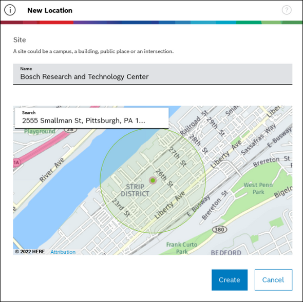
This version adds a dialog to select the geographic location of the project site. Search location via address, point-of-interest or latitude/longitude.
Project location is used as working area for camera calibration, so it only has to be specified once and not for each and every camera.

Camera Calibration
Major UI/UX improvements
Sidebar Navigation
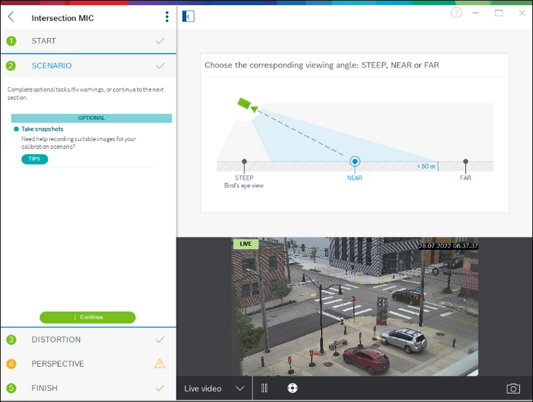
The workflow and navigation between individual steps is now part of the sidebar. This makes calibration progress easily visible and the workflow between steps is more natural.
For small screens the sidebar can be collapsed on demand to get more screen space for content and editing.
Parameter Controls
Reworked parameter UI in perspective step to more clearly indicate if a value is calculated, read from a sensor or measured by the user.

Image Controls
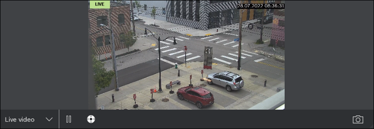
Camera image controls are now more condensed, the thumbnail list is only shown on demand and gets out of the way when not needed.
The different sources - live, clip, snapshots and recording - are clearly separated now.
Start page with live status
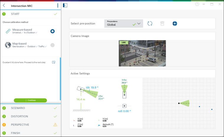
Project Assistant 2.3 introduces a new start page which provides extensive information on the current calibration status of the camera.
- Live visualization of currently active calibration on camera
- PTZ camera control - steer camera or select pre-positions
- Calibration method selection
Live visualization of active settings
Calibration method selection
Project Assistant 2.3 introduces a completely new map-based workflow. Choose the method most suitable for your scenario and use-case.
- Measure-based
Standard method from previous versions. Provide measurement of image features to calibrate the camera.
Universally applicable for indoor and outdoor scenarios. - Map-based
Determine calibration from corresponding points in image/map. Uses satellite imagery and is therefore only available for outdoor scenarios.
Well suited for use cases like traffic monitoring or smart city applications.

Map-based calibration
We added a completely new calibration workflow for outdoor scenarios. The approach is based on corresponding points in image and map,
the only requirement is good satellite coverage of the site.
The workflow provides the global geolocation (WGS84) and orientation of the camera, enabling fully georeferenced analytics metadata.
Map-based calibration works well for use-cases like traffic monitoring or smart city.

Verification Tools
Several tools are provided to verify the map-calibration result.
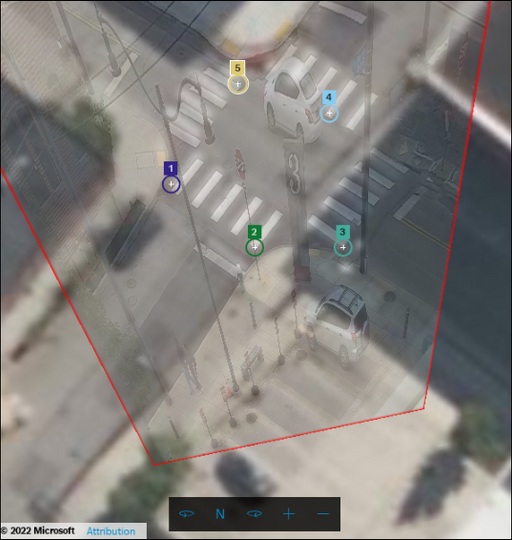
Camera Overlay
Once a solution is available, a camera image overlay is shown on the map. This provides a good indication on the quality of the mapping between image and world.
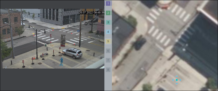
3D Avatar
Use 3d avatar to check mapping of positions on map and image.
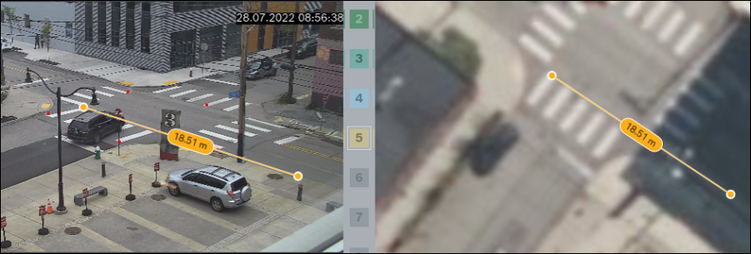
Measure Tape
Measure distances on ground or vertically in map or image.
Map Controls & Helpers
Control zoom level and rotation of the map view.

Right-click anywhere on the map to show the location context menu.
- Open in Google Maps - opens the location at the mouse cursor in Google Maps/Street View. This is helpful when not on-site and more information on the location is desired.
- Copy latitude and longitude to clipboard - paste into other map application/services or share location.

Live Analytics Diagnostics
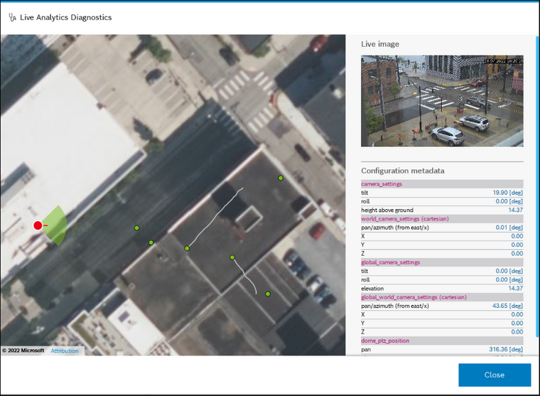
With Live Analytics Diagnostics the metadata produced by Intelligent Video Analytics can be inspected live.
This helps checking if IVA produces the desired output after calibration.
The tool visualizes:
- Camera location and orientation
- Objects and trajectories with georeferenced metadata
- Detailed raw configuration data for diagnostics/support purposes
Note: currently only available for map-based calibration.
Additional Changes
- Optimized WLAN usage: reduced scan frequency to improve connection quality
- Improved PTZ camera support
Still looking for something?
- Top Results